Death Valley National Park Trip Report & Map
Southern California got hit with a big series of winter storms at the end of February, so the original plan of going to Yosemite got cancelled, then the secondary plan of going to Alabama Hills in the Eastern Sierra Nevada’s got cancelled, so the teritiary plan of “settling” on Death Valley went into effect. And let me tell ya, it was anything but settling!

Snow falling on the I-15 driving over the San Gabriel Mountains!
Having never been to the park before we were excited to mark another one off the bucket list, but didn’t know what else to expect besides its the hottest, driest, and largest national park in the country! Well, going at the end of February the only of those that were true was that it was the biggest park. They had just come off two straight days of rain, and the temps while nice in the day in the 60s was dropping into the 40s at night. So that meant many of the roads in the park were closed the day we showed up, luckily we were just one of a handful of people that decided to travel during that stormy weekend so we had the pick of the campsites at Texas Springs Campground near the Furnace Creek entrance and visitor center.

So we set up camp, fired up our TactiCool Fire Pit, poured the whiskey, and grilled up a tri-tip we had marinating in teriyaki for the last two days. That’s a camping tradition for us, no matter where we go or for how long, the first night is always a teriyaki tri-tip. Its so easy and always a hit, just throw some meat in a zip lock bag full of teriyaki and let it sit for 48 hours. Grill it up to whatever temp you desire, and you can thank me later!

Party lights and Tri-Tip in full effect!
The next day we woke up to beautiful mountain ridges covered with snow. This is the part that really surprised me, I knew they were warning of snowy conditions at high altitudes, but I never expected such a view in the desert!
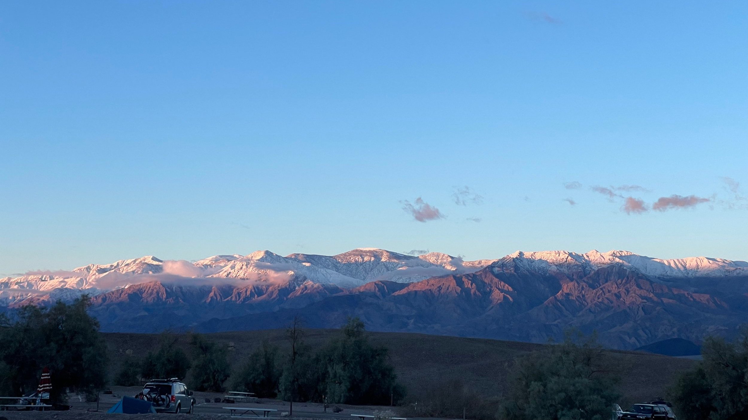
The mountain view from our roof top tent in the morning
After breakfast we went for a little walk down to the Furnace Creek Visitor Center to check on the road conditions because we really wanted to get into the back country and do some dispersed camping. From the campground the walk was about a mile, but the weather was perfect. I walked in jeans and a t-shirt with a beer in one hand and enjoyed the weather and scenery! Roads still weren’t quite ready for back country travel, so we explored the Furnace Creek resort area a bit, had a drink at the golf course, and walked back and enjoyed the camp ground for the day!

At sunset we walked up a small hill next to the campground to see the valley and the beautiful colors the sun was creating. We were able to bring up our O.G. TactiCool Fire Pit and a 5 pound propane tank very easily, and sat and enjoyed the beautiful sunset! At one point a ranger came up to us to tell us to put the fire out, but after realizing what it was he thought it was too cool and said it was allowed to use outside the established campgrounds!

The O.G. Ammo Can TactiCool Fire Pit overlooking Death Valley at Sunset
The next morning we packed up camp, went to the visitor center to get our permit for camping in Echo Canyon - The Ranger warned us that there were no charcoal-producing fires allowed in the back country, but said our TactiCool Fire Pits were perfectly legal there! We got site #7, so we filled up on gas (ugh…so expensive), propane, and ice and headed out. We stopped by Badwater Basin first to see the lowest point in the USA, then drove through Artist’s Palette Drive - gorgeous! Its a 9 mile, one way (south to north) road that winds back through canyons and hills with a few stops and overlooks and is absolutely gorgeous, so many colors I highly recommend!

Yep, thats is U.S. Dollars….
After Artist’s Palette, we made our way to Echo Canyon Road and back to our campsite #7. The Ranger’s warned we would need high clearance 4x4 to get back there, which we had three of so no issues. But I was able to make it back without switching over to 4WD at all, although there are some deep gravel spots you could get stuck in. The canyon was gorgeous, but so windy. We got back to the spot and the winds through the canyon walls were howling. We decided to not set up camp and left to find something else.

Doing it for the ‘gram…
We ended up driving 20 miles north of Furnace Creek to the Stovepipe Wells Campground. It was nice to have a change of scenery, but the campground itself was essentially a large parking lot. We took the back right corner to have some semblance of the desert and seclusion. Again, luckily there weren’t very many people out braving the weather those days. But after we made a late lunch, a gust of wind came through knocking over one of the tents and our taco meat right off the skillet onto the ground! Worst of all, the wind didn’t stop. We were in a full-on dust storm with winds gusting to 50mph. We made the decision to hastily break down camp and get a room at the nearby Stovepipe Wells Hotel. It was an unexpected $220 detour, but better than trying to sleep in a rooftop tent at 50mph winds. So I went to the saloon, had a few beers and decent burger and went to bed!

Stovepipe Wells Campground before the winds came!
The next morning the winds were gone! We went to the campsite to find everything covered in sand, dusted it off and set up camp again. We made breakfast, and went on a hike through Mosaic Canyon (highly recommend this hike!). Once we got back it was lunch time, and Wagyu Burgers were on the menu today! But as we were making food the Ranger came by to check the campsite and let us know the winds were forecast to come back again that night. So we made the tough decision to pack up before the winds started and head south back to San Diego.
Overall it was a fantastic trip. Definitely not the one we planned for, but that’s why we had options. There’s so much left to explore within Death Valley, and bummed we didn’t get to make it out to Darwin Falls on the West side of the park, an oasis and waterfall within the driest desert in the USA! Hopefully this helps with some planning and if you have any questions about the trip please reach out to us on Instagram (@tacticool_firepits), happy to help!
Also, below is a Google Map we made with some of the highlights in the park, and camp grounds. To include the GPS coordinates of all the designated dispersed camping sites along Echo Canyon and Hole in the Wall Roads (which is not listed on the national park website for some reason…). Remember, if you’re going back there you need to get a free permit from the Furnace Creek Visitor Center to camp, and you cant have wood fires. If you’re going to want a fire to stay warm or for the ambience amongst the canyon walls go check out our portable propane ammo can fire pits, perfectly legal for the back country, and takes up way less space than wood or those big round pits too!